
“Want to know more about Mount Kinabalu Trail Map, Via Ferrata Map, and also Kinabalu Park Map? What about Guided Kinabalu Park Hiking Trail details? You may find all the comprehensive information about your Mount KK Trail here!”


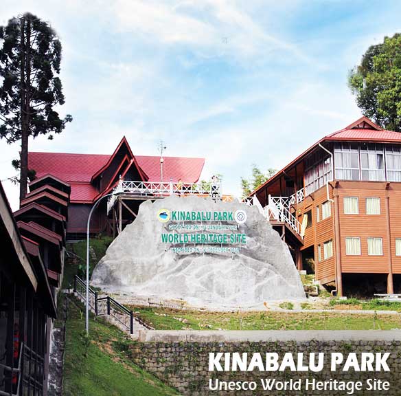
KINABALU PARK is Malaysia’s first World Heritage Site designated by UNESCO in December 2000 for its “Outstanding Universal Values”. Established in 1964, the Park plays an important role in protecting the surrounding land and the tallest mountain on the island of Borneo.
The main entry point for visitors is the Park Headquarters which located about 92 km from Kota Kinabalu, approximately two hours’ drive from the city. For Instance, Kinabalu Park is an awesome getaway for nature lovers which covers an area of 754 sq km (from Park HQ to Poring Hot Spring). In addition, this botanical paradise is blessed with an astonishing variety of flora and fauna that ranges over 4 climate zones. The temperature at the Park range from 15 to 20 degree, so pack warmly.
Besides that, it is dominated by Mount Kinabalu (4,095m), the highest mountain between the Himalayas and New Guinea. Therefore, Kinabalu Park has a very wide range of habitats, from rich tropical lowland and hill rainforest to tropical mountain forest and sub-alpine forest. Around 5,500 plant species (with a variety of orchids and pitcher plants), about 326 bird species, and more than 100 mammals can be found in here.
Apart from that, there are 9 great Kinabalu Park Hiking Trails within the Kinabalu Park area ready for explore! In addition, things to do in Kinabalu Park include bird watching, mountain climb, jungle trek, visit the Park’s conservation centre and botanical garden.
LIWAGU RIVER TRAIL
Distance: 5,620 Metres
Duration: 2 Hours
Named after the river that the trail follows upstream, Liwagu Trail crosses small streams, narrow ridges and enters lush canopy of trees making for an exciting trail.
SILAU SILAU TRAIL
Distance: 3,057 Metres
Duration: 1 Hour 30 Minutes
Besides it being an easy Kinabalu Park Hiking Trail, this trail is most frequented by visitors as there are many entry and exit points. Therefore, trekkers have the flexibility of either completing the 3KMs trail or not. Following a stream, the trek is flat and moist. Covered in moss, ferns and wild orchids.
BUKIT BURUNG TRAIL
Distance: 1,802 Metres
Duration: 1 Hour
Well-worn by bird watchers, this trail is fairly short and leads to the top of a hill for bird watching. Start from the road, cross the Silau-Silau stream and trail, then proceed up the ridge side to Bukit Burung shelter for a spectacular view of the Park Headquarters, Lower Liwagu Valley and Mount Kinabalu. Attractions include easy access to a hill forest, cool stream valleys and dry ridge tops.
KIAU VIEW TRAIL
Distance: 2,544 Metres
Duration: 1 Hour 30 Minutes
From the arch at the park entrance, proceed along a wide undulating ridge trail. The trail attractions include scenic views of the west coast and an assortment of local tree species. Chances of spotting a pitcher plant on this trail is high, so do watch out of them.
BUNDU TUHAN VIEW
Distance: 465 Metres
Duration: 15 Minutes
As one of the shortest routes at the park, it only takes a few minutes to reach the sheltered viewpoint from nearby the Kinabalu Conservation Centre. For Instance, the viewpoint offers great views of the Bundu Tuhan Village and also the southern mountains including Malaysia’s second highest peak, Mount Trusmadi (2,642 metres). Then, continue on to the 5KMs Liwagu River Trail, or walk back to the park’s HQ.
PANDANUS TRAIL
Distance: 598 Metres
Duration: 20 Minutes
The Pandanus Trail opened in September 1999 for the World Mountain Trophy Race. Is a broad well graded trail offering refreshing views. This trail may be a mere 598 metres, but do not underestimate it as it is quite steep, crisscrossing into the Kiau View Trail.
BUKIT ULAR HILLSIDE TRAIL
Distance: 997 Metres
Duration: 30 Minutes
Its best to hitch a ride to Timpohon Gate, then use the Bukit Ular Trail on the way down. At such an altitude and such a distance from the park’s headquarters, this trail is rarely visited which makes it a great path to take for serene forest walks. It also offers opportunities to see birds, pitcher plants and lots of squirrels.
MEMPENING TRAIL
Distance: 2,516 Metres
Duration: 1 Hour 30 Minutes
“Mempening” means Oak in Malay, a type of tree which grows in abundance around the trail. Start half way up Power Station Road, trek down the ridge through dense oak chestnut forest to Bukit Tupai and Silau-Silau stream. Good view of Park Headquarters and Liwagu Valley.
BUKIT TUPAI TRAIL
Distance: 345 Metres
Duration: 15 Minutes
From Multi-purpose Hall, cross Silau-Silau stream and trail, going straight up to ridge crest and Bukit Tupai Shelter. Splendid view of Park Headquarters and tree canopy area. On clear days, breathtaking view of Mount Kinabalu. Ridge crest links to Mempening and Bukit Burung Trail.
Guests wishing to trek along these Kinabalu Park Hiking Trail must be accompanied by either a Sabah Park Ranger or Naturalist. We will not be held responsible for any death, injuries, loss and/or damage howsoever caused to trekkers. All guests trek at their own risks.